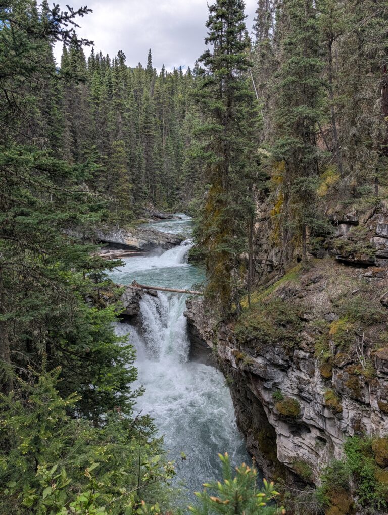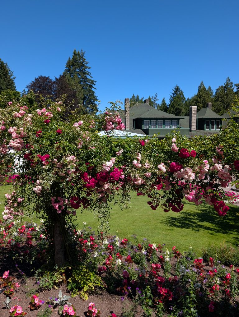

The Ultimate Canada Road Trip Itinerary: Quebec to Vancouver
This post contains affiliate links. If you make a booking or purchase through one of these links, I may earn a small commission at no additional cost to you. Your support helps me continue creating honest, firsthand travel guides—thank you! Read my full affiliate disclosure for more information.
Whenever I travel abroad, people often ask me what Canada is like. It is my home country, yet I realized there was still so much of it I had never experienced for myself.
Driving across Canada had been on my travel wish list for years, but I did not want to rush from one major city to another just to say I had crossed the country. I wanted to experience the landscapes in between: Northern Ontario’s lakes, Manitoba’s wildlife, Saskatchewan’s open prairies, Alberta’s mountains and badlands, and British Columbia’s forests and coastline.
This Canada road trip itinerary follows the exact route I drove from Quebec to Vancouver and breaks it down leg by leg, including driving times, the best stops, scenic viewpoints, hikes, wildlife experiences, and lesser-known places worth adding along the way. I also include part of my return journey east, since I intentionally saved a few destinations and scenic routes to experience on the way home.
You could technically drive from Montreal to Vancouver in less than a week, but you would miss most of what makes the journey worthwhile. I recommend about 4 to 6 weeks for the westbound journey if you want time to actually explore. With the return route and extra stops, my full adventure stretched closer to eight weeks on the road.

The Ultimate Canada Road Trip at a Glance
Think of this post as the big-picture overview of my entire Canada road trip. I’ve broken the journey into 16 driving legs so you can see how the route connects from Montreal to Vancouver, including a few optional extensions and part of my return journey east.
Over the next few weeks, I’ll also be publishing more detailed guides for many of these individual routes and destinations, with deeper itineraries, activity recommendations, practical tips and everything I learned along the way. If you want those as they go live, join my newsletter to get the latest blog posts straight to your inbox.
Along the way, the trip crosses six provinces and takes you through Northern Ontario’s lakes, Manitoba’s wildlife, Saskatchewan’s open prairies, Alberta’s Rockies and Badlands, and British Columbia’s forests, coastline and wine country.
Starting your road trip a little farther east? If you have a few extra days before heading west, Quebec City makes an easy addition before Montreal. I’ve put together my 25 best things to do in Quebec City guide, covering Old Quebec, local neighbourhoods, riverfront spots, Île d’Orléans and some of my favourite experiences beyond the historic centre.
If you have time for that extra stop, my two-day Quebec City itinerary brings together Old Quebec, the ferry to Lévis, Montmorency Falls and a taste of Île d’Orléans before you continue toward Montreal.
- Montreal, Quebec → Sudbury, Ontario
- Sudbury → Wawa, Ontario
- Wawa → Thunder Bay, Ontario
- Thunder Bay → Kenora, Ontario
- Kenora → Winnipeg, Manitoba
- Optional: Winnipeg → Riding Mountain National Park
- Riding Mountain → Cypress Hills, Saskatchewan
- Cypress Hills → Canmore and Banff, Alberta
- Banff → Jasper via the Icefields Parkway
- Jasper → Clearwater, British Columbia
- Clearwater → Vancouver via Coquihalla Canyon
- Optional: Vancouver Island Extension
- Optional: Sea to Sky Highway Extension
- Return route: Vancouver → Okanagan Valley, BC’s Wine Country
- Osoyoos → Banff / Calgary through the Kootenays
- Calgary → Drumheller and Dinosaur Provincial Park
I drove this journey in my electric vehicle, which added its own layer of planning along the way. Rather than getting too deep into charging and range here, you can read my 10 Lessons Learned From My Road Trip Across Canada in an EV for the apps, adapters, charging strategy and real-life lessons from the road.
For each leg of this itinerary, I’ll focus on the approximate distance and driving time, the stops I actually made, and the places I think are worth slowing down for.
Ready? Let’s drive across Canada.
Section 1: From Montreal, Quebec, to Sudbury, Ontario
Driving distance: Approximately 680 kilometres
Driving time: Around seven hours without extended stops

The drive from Montreal to Sudbury marks the beginning of the journey into Northern Ontario. Although you can complete it in one day, stopping in Ottawa or Pembroke makes the route more enjoyable.
Explore Ottawa
Walk around Parliament Hill, explore the ByWard Market or stretch your legs beside the Rideau Canal before continuing west. Even a few hours in Canada’s capital can break up the drive without taking you far from the main route.
Stop in Pembroke
Pembroke makes an easy overnight stop before continuing deeper into Northern Ontario. Walk along the Waterfront Boardwalk, stop for a picnic beside the Ottawa River or enjoy a quiet evening by the water.
Stop in North Bay
North Bay is worth a scenic stop before Sudbury. Consider Shabogesic Beach, Duchesnay Falls, or a Lake Nipissing cruise—I’d especially recommend a sunset cruise if the timing works.
I arrived a little too late for one, so I stayed by the marina and waterfront instead, and the sunset over Lake Nipissing was absolutely beautiful.
Explore Sudbury
Sudbury deserves more than a quick photo beside the Big Nickel. The city sits within the Sudbury Basin, a 1.85-billion-year-old impact structure, and contains 330 lakes within its municipal boundaries.
Visit the Big Nickel before heading to Bell Park for a walk along Ramsey Lake. For something more active, hike the Point Trails Loop at Lake Laurentian Conservation Area. The rocky trails, forests and lake views reveal a completely different side of Sudbury from the industrial image many travelers associate with the city.
Where to Stay in Sudbury
Choose accommodation beside a lake whenever possible. I rented a place with direct water access and took a kayak onto the lake. Staying near the water allows you to experience the landscape that defines Northern Ontario, whether you are paddling at sunset, drinking coffee on the dock or simply enjoying the stillness.
Section 2: From Sudbury to Wawa, Ontario
Driving distance: Approximately 530 kilometres
Driving time: Around six hours without extended stops
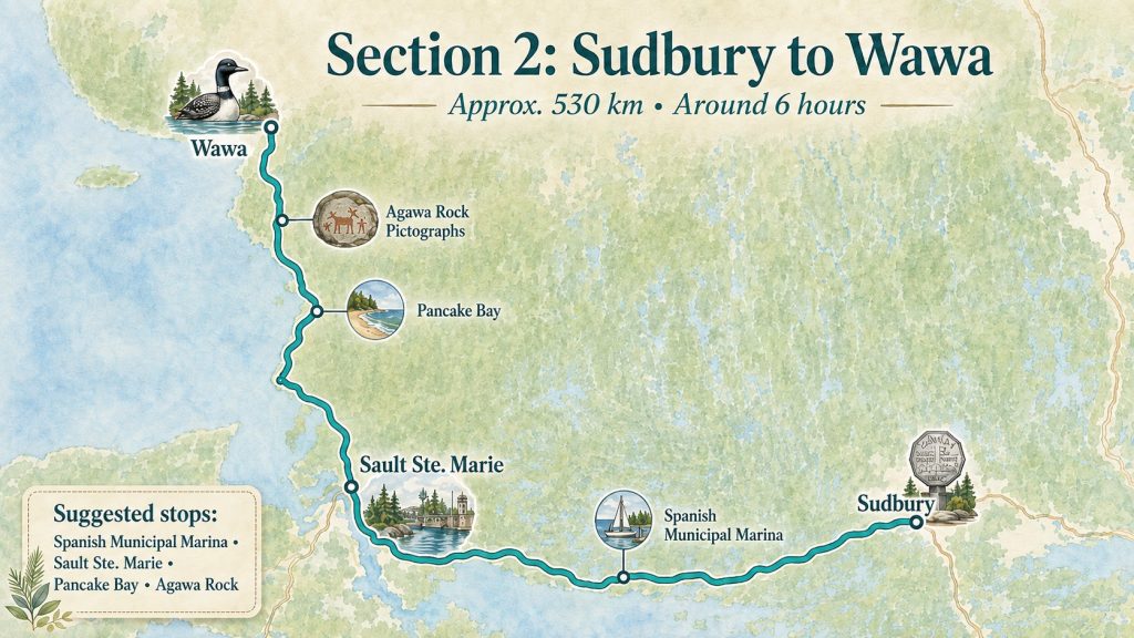
The drive from Sudbury to Wawa takes you deeper into Northern Ontario and toward the dramatic shoreline of Lake Superior. Although you can complete the route in one day, several stops are worth adding.
Stop at the Spanish Municipal Marina
Pause for lunch or a picnic beside the water, walk around the marina and enjoy the views before continuing toward Sault Ste. Marie.
Explore Sault Ste. Marie
Walk along the Sault Ste. Marie waterfront or explore the peaceful trails on Whitefish Island. Before continuing north, stop near Second Line West for one of your first glimpses of Lake Superior.
Drive the Lake Superior Shoreline
The road between Sault Ste. Marie and Wawa was one of the first sections of my trip that made me realize how extraordinary Northern Ontario really is.
The highway follows parts of the Lake Superior shoreline, passing forests, beaches, cliffs, waterfalls and provincial parks.
Do not treat this as a simple transfer day. Some of the best moments come from pulling over and giving yourself more time than the map suggests.
Stop at Pancake Bay Provincial Park
Pancake Bay is a beautiful place for a picnic, swim or paddle. Its long sandy beach and clear water can look almost tropical on a calm day—until you step into the cold lake.
Visit the Agawa Rock Pictographs
The red ochre paintings at Agawa Rock were created by Ojibwe people on the rock face beside Lake Superior. The trail is a short 800-metre loop, but access depends heavily on weather, waves and water conditions.
Explore Wawa
I stayed in a glamping dome at Rock Island Lodge beside Lake Superior, and it became one of the most memorable overnight stays of my trip.
The lodge is a beautiful base for sea kayaking or simply relaxing beside the lake.
While in Wawa, take the classic photo beside the Wawa Goose and visit Young’s General Store. These quirky Canadian attractions belong on a cross-country road trip.
Section 3: From Wawa to Thunder Bay, Ontario
Driving distance: Approximately 520 kilometres
Driving time: Around five and a half hours without extended stops

This section is filled with waterfalls, beaches, Lake Superior Circle Tour attractions and dramatic views over the lake. There is a lot to see, so allow more time than the driving distance suggests.
Stop in White River
Visit the Winnie-the-Pooh Memorial. The town is connected to the real bear that inspired the famous character, making it an easy and interesting roadside stop.
Visit Pebble Beach in Marathon
Stop at Pebble Beach in Marathon to experience a completely different side of Lake Superior. The rounded stones, crashing waves and rugged shoreline create a wild, moody landscape that feels worlds away from the sandy beaches farther east.
Explore Terrace Bay
Easy stops include:
- Terrace Bay Lighthouse
- Terrace Bay Beach
- Aguasabon Falls and Gorge
Aguasabon Falls was one of my favorite easy-access waterfall stops in Northern Ontario. A short trail leads to a viewpoint over the falls and deep gorge.
Stop in Nipigon
Visit the Bridgeview Lookout Tower for elevated views over the river and bridge. It also makes a convenient picnic stop before continuing west.
Visit Ouimet Canyon
A short trail through Ouimet Canyon Provincial Park leads to viewing platforms overlooking a massive canyon with steep rock walls. The scenery feels surprisingly dramatic for a stop that is so easy to access.
Mine Your Own Amethyst
For something completely different, visit an amethyst mine near Thunder Bay, such as Diamond Willow Amethyst Mine. You can search for and collect your own pieces of amethyst—a playful, hands-on contrast to the hiking trails and viewpoints along the route.
Explore Thunder Bay
Visit the Terry Fox Monument, one of the most meaningful stops along the Trans-Canada Highway.
With additional time, consider:
- Kakabeka Falls
- Sleeping Giant Provincial Park
- Thunder Bay’s waterfront
Sleeping Giant is not a quick roadside stop—it is one of the real adventures of this route. If you plan to hike, give it a full day and do not squeeze it into an already packed driving schedule.
For an even more memorable way to experience the park, consider the Sail Superior Sleeping Giant Zodiac Adventure. The trip takes you across Lake Superior by Zodiac, past Ontario’s highest cliffs, before reaching the Sleeping Giant. From there, you can hike into the park, take in panoramic views over the lake, and even cool off with a swim.
Section 4: From Thunder Bay to Kenora, Ontario
Driving distance: Approximately 490 kilometres
Driving time: Around five hours and 40 minutes without extended stops

The landscape gradually shifts as you travel west, but water remains at the heart of the journey. Kenora sits on Lake of the Woods, one of the most beautiful lake regions along the route.
Walk Along the Kenora Waterfront
Start with a waterfront walk and stop beside Husky the Muskie, the town’s enormous fish statue. Yes, it is another giant Canadian roadside attraction—and yes, you should take the photo.
Hike Tunnel Island
The Tunnel Island trails offer peaceful forest paths and shoreline views close to town. I spotted a bald eagle, deer and a fawn here. Wildlife is never guaranteed, but the trail is worthwhile even without a sighting.
Cruise Lake of the Woods
Take a sightseeing cruise aboard the M.S. Kenora for a broader view of the region. Lake of the Woods contains thousands of islands, and seeing it from the water helps you understand its scale.
Section 5: From Kenora to Winnipeg, Manitoba
Driving distance: Approximately 210 kilometres
Driving time: Around two and a half hours without extended stops
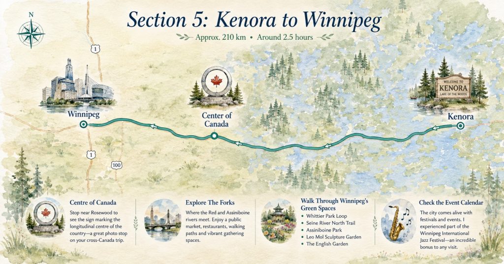
After several days of forests, waterfalls and small Northern Ontario communities, Winnipeg feels like a major change of pace.
Stop at the Centre of Canada
Shortly before Winnipeg, stop at the Centre of Canada sign near Rosewood. It marks the longitudinal centre of the country and makes a fitting photo stop during a cross-Canada journey.
Explore The Forks
Begin at The Forks, where the Red and Assiniboine rivers meet. The area includes a public market, restaurants, walking paths and gathering spaces. It is one of the easiest places to spend an afternoon without needing a strict plan.
Walk Through Winnipeg’s Green Spaces
Some of my favorite walks included:
- Whittier Park Loop
- Seine River North Trail
- Assiniboine Park
- Leo Mol Sculpture Garden
- The English Garden
The English Garden was a particular highlight. After spending so many days moving west, slowing down among the flowers offered a welcome change of rhythm.
Check the city’s event calendar before visiting. I happened to experience part of the Winnipeg International Jazz Festival, which brought even more energy to the city.
Section 6: Optional Stop at Riding Mountain National Park
Driving distance: Approximately 300 kilometres from Winnipeg
Driving time: Around three hours without extended stops
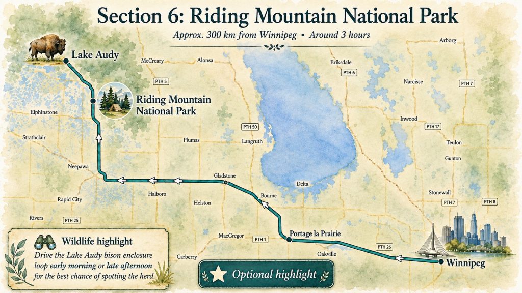
Riding Mountain National Park is an optional stop on the journey west, but for me, it was easily one of the highlights of the trip. I came mainly for Lake Audy, where a wild bison herd lives inside the park, and I stayed at the Wasagaming campground before continuing west the next day.
I drove the bison enclosure loop around 5 p.m. and got incredibly lucky—the herd crossed directly in front of me. It was one of the most unforgettable wildlife moments of the entire road trip.
Section 7: From Riding Mountain to Cypress Hills, Saskatchewan
Driving distance: Approximately 780 kilometres via Fort Qu’Appelle
Driving time: Around eight and a half hours without extended stops

If you skipped the optional Riding Mountain stop, you can drive directly from Winnipeg to Cypress Hills, which is approximately 1,040 kilometres and around 10 hours of direct driving. Either way, this is one of the longest sections of the trip, and I strongly recommend splitting it over two days.
Driving across Saskatchewan is scenic, but the landscape can also become repetitive after hours of prairie, farmland and straight roads. Breaking up the journey with a few worthwhile stops made this stretch much more enjoyable for me.
Drive Through the Qu’Appelle Valley
Fort Qu’Appelle and the Qu’Appelle Valley make a great change of scenery. As you descend into the valley, the open prairie suddenly gives way to hills and lakes.
Stop at Katepwa Point Provincial Park for a picnic, a walk by the water or simply a break from driving.
Enjoy the Prairie Along the Way
Part of the experience is simply watching Saskatchewan unfold from the road: grain fields, small towns, wide-open skies and seemingly endless horizons.
Explore Cypress Hills Interprovincial Park
Cypress Hills is a rewarding place to finish the long drive across Saskatchewan. After hours of open prairie, the forested hills and higher elevation feel completely different.
Highlights include:
- Bald Butte
- Lookout Point
- Dark-Sky Preserve
- Picnic areas and hiking trails
If you can, spend the night in or near the park.
Section 8: From Cypress Hills to Canmore and Banff, Alberta
Driving distance: Approximately 700 kilometres
Driving time: Around seven hours without extended stops
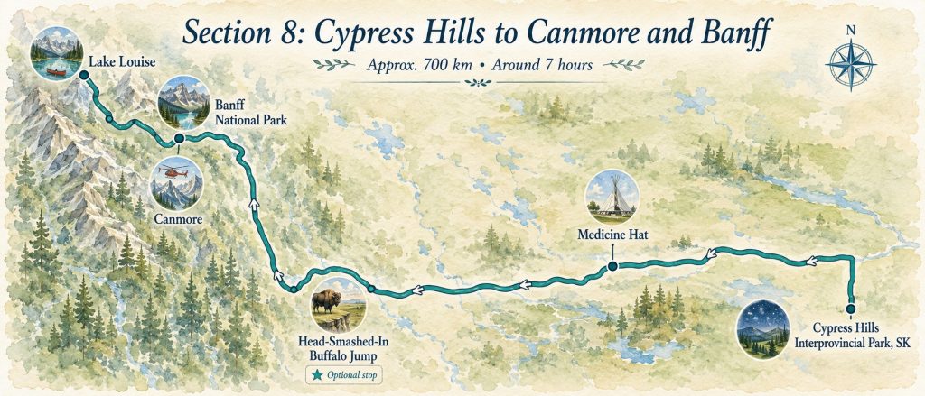
This leg takes you from the rolling landscapes of Cypress Hills through Medicine Hat and across southern Alberta before the Rockies finally begin to rise ahead of you.
Stop in Medicine Hat
Break up the drive with a stop in Medicine Hat.
Visit the enormous Saamis Tepee, which stands above the surrounding coulee landscape, or explore Medalta in the Historic Clay District to learn more about the region’s pottery and industrial history.
Medicine Hat makes an easy transition between the prairies and the mountain landscapes ahead.
Optional Stop: Head-Smashed-In Buffalo Jump
If you have additional time, consider stopping at Head-Smashed-In Buffalo Jump near Fort Macleod on your way west.
This UNESCO World Heritage Site shares the history of an Indigenous hunting practice used on the plains for thousands of years and adds meaningful cultural context to the landscapes you have been driving through.
Continue to Canmore
As the Rocky Mountains appear on the horizon, the scenery changes dramatically.
Canmore makes an excellent base for exploring the region. It is surrounded by mountains, has plenty of accommodation and restaurants, and often feels a little calmer than Banff.
Take a Helicopter Flight Over the Rockies
One of the most unforgettable experiences of my road trip was a helicopter flight with Alpine Helicopters in Canmore. From above, the Rockies looked completely different, with views over Mount Assiniboine, glaciers, alpine lakes and sharp mountain ridges.
It is definitely a splurge, but if you want to see the scale of the mountains from an entirely different perspective, this is an incredible way to do it.
I share the full experience in my Canmore helicopter tour review, including the route I chose, what I paid and what the 35-minute flight was actually like.
Spend a Day Exploring Banff
Inside Banff National Park, consider visiting:
- Cascade Gardens
- Bow Falls
- Vermilion Lakes
- Banff town
- Johnston Canyon
At Johnston Canyon, continue to the Upper Falls if time allows. The tunnel viewpoint near the Lower Falls can develop long lines during peak season, so early morning or later afternoon is your best bet.
Visit Moraine Lake and Lake Louise
Private vehicles are generally not permitted on Moraine Lake Road, so arrange a shuttle or approved transportation in advance. I booked a double-decker shuttle with parking near Lake Louise, which made it easy to visit both lakes in one day.
At Moraine Lake, I rented a canoe and paddled beneath the Valley of the Ten Peaks. It was expensive, but being out on that turquoise water away from the busiest viewpoints was completely worth it.
At Lake Louise, beat the crowds by walking the Lakeshore Trail or continuing toward the Plain of Six Glaciers for quieter views. On a warm summer day, the turquoise water can be hard to resist—I took a quick cold plunge, and it ended up being one of my favorite memories from the trip.
If you’re planning these two lakes specifically, my one-day Lake Louise and Moraine Lake guide covers the transportation strategy I used, canoeing and how I divided my time between both lakes.
Planning a few days in this part of the Rockies? My Banff National Park 3-day itinerary brings together my time in Canmore and Banff, canoeing on Moraine Lake, exploring Lake Louise, and driving the Icefields Parkway toward Jasper, with a day-by-day breakdown to help you plan your own stops.
Section 9: From Banff to Jasper via Yoho and the Icefields Parkway
Driving distance: Approximately 340 kilometres, excluding local detours
Driving time: Around four hours without stops
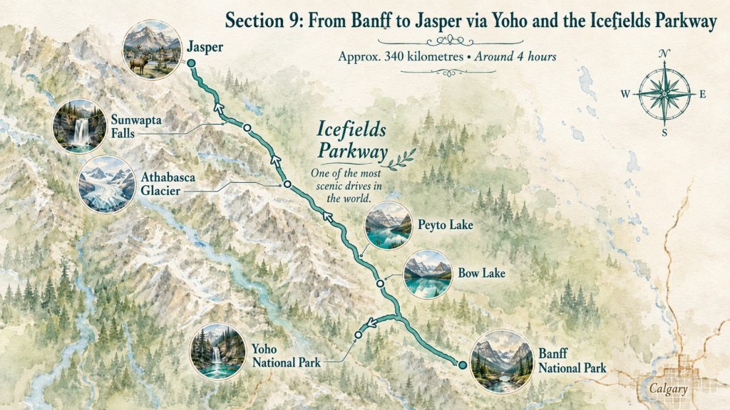
This section combines Yoho National Park with one of the most scenic drives in Canada.
Explore Yoho National Park
Cross briefly into British Columbia to visit:
- Emerald Lake
- Natural Bridge
- Spiral Tunnels Viewpoint
- Takakkaw Falls
Emerald Lake is a beautiful place to walk, canoe or stop for lunch. Natural Bridge requires less time and is easy to combine with the lake.
Drive the Icefields Parkway
The Icefields Parkway between Lake Louise and Jasper is often described as one of the world’s most scenic drives—and this is one description I will not argue with.
The road passes turquoise lakes, glaciers, waterfalls, mountain viewpoints and trailheads almost continuously. Wildlife sightings may include grizzly bears, black bears, bighorn sheep and elk.
My favorite stops included:
- Hector Lake Viewpoint
- Bow Lake
- Crowfoot Glacier
- Peyto Lake
- Bow Summit
- Waterfowl Lake
- Howse Pass Viewpoint
- Toe of the Athabasca Glacier Trail
- Beauty Creek
- Sunwapta Falls
- Athabasca Falls
For a closer look at this stretch, my guide to the best Icefields Parkway stops follows the route I drove from Lake Louise to Jasper, including Bow Lake, Peyto Lake, Athabasca Glacier and Athabasca Falls.
Stop at Bow Lake and Peyto Lake
Walk beside Bow Lake and admire the surrounding mountains. I also took another cold plunge here, although that part is entirely optional.
At Peyto Lake, a short uphill trail leads to the famous turquoise viewpoint. Continue beyond the busiest platform when the trails are open for additional perspectives and more breathing room.
If Peyto Lake is one of your priority stops, my complete Peyto Lake guide covers the viewpoint walk, parking, how much time to allow and why the lake has that incredible turquoise colour.
Walk Toward the Athabasca Glacier
The Toe of the Athabasca Glacier Trail allows you to approach the glacier independently. Markers along the path reveal how dramatically the ice has retreated, making the effects of climate change feel immediate rather than theoretical.
End in Jasper
Finish the day in Jasper and allow time to walk around the village. Depending on current park conditions, you can also visit Athabasca Falls, Sunwapta Falls or ride the Jasper SkyTram.
Section 10: From Jasper to Clearwater, British Columbia
Driving distance: Approximately 320 kilometres
Driving time: Around three hours and 45 minutes without extended stops

This route carries you out of the Rockies and deeper into British Columbia.
Stop at Mount Robson Provincial Park
On a clear day, Mount Robson dominates the landscape. Stop near the visitor centre or café for a picnic and mountain views. For a short hike, follow the Overlander Falls Trail through the forest to a waterfall on the Fraser River.
Go Bear Watching in Blue River
The River Safari in Blue River was one of those completely unexpected stops that ended up becoming a highlight of the trip.
The three-hour excursion takes you through the surrounding river and lake system, with incredible views toward the glaciers and the chance to spot wildlife along the shoreline. I was lucky enough to see black bears during my ride, which made the experience even more memorable.
Wildlife sightings are never guaranteed, but between the scenery, the glacier views and the possibility of seeing bears or moose, I thought this experience was absolutely worth making time for.
Stay Near Clearwater
Spend the night near Clearwater or North Thompson River Provincial Park.
Clearwater is the gateway to Wells Gray Provincial Park, known for waterfalls and outdoor adventures. With an extra day, visit Helmcken Falls, Dawson Falls or join a rafting excursion.
Section 11: From Clearwater to Vancouver via Coquihalla Canyon
Driving distance: Approximately 475 kilometres
Driving time: Around five and a half hours without extended stops
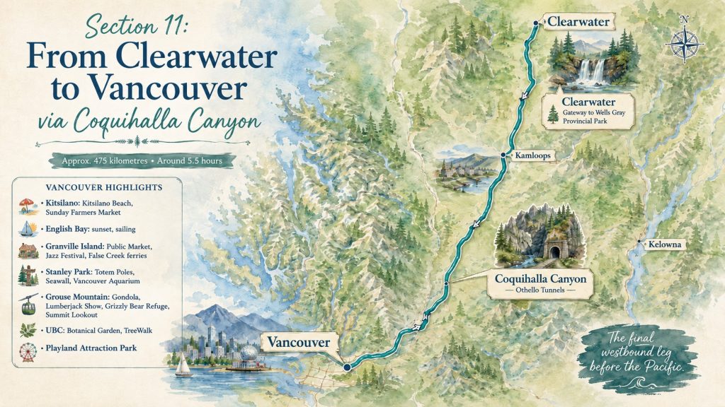
The drive from Clearwater to Vancouver is the final major leg of the westbound journey, and I chose to make it more interesting by routing through Coquihalla Canyon Provincial Park and the Othello Tunnels before continuing toward the coast. The historic tunnels and narrow canyon make a worthwhile break from the highway and add one last dose of adventure before reaching Vancouver.
Reaching Vancouver after driving across Canada feels significant. You have crossed Northern Ontario’s forests and lakes, watched bison in Manitoba, driven beneath Saskatchewan’s enormous skies and travelled through the Rockies before finally reaching the Pacific.
Vancouver deserves more than a quick stop, so I recommend giving yourself at least a few days here. I spent three weeks based in the city, and I’ve rounded up my 25 Best Things to Do in Vancouver, BC, including neighbourhoods, beaches, North Vancouver, outdoor experiences and a few worthwhile trips beyond the city.
Only have a few days in Vancouver? My three-day Vancouver itinerary organizes the city’s waterfront, neighbourhoods and North Vancouver mountains into a realistic day-by-day plan.
Here are a few highlights to get you started.
A Few Vancouver Highlights
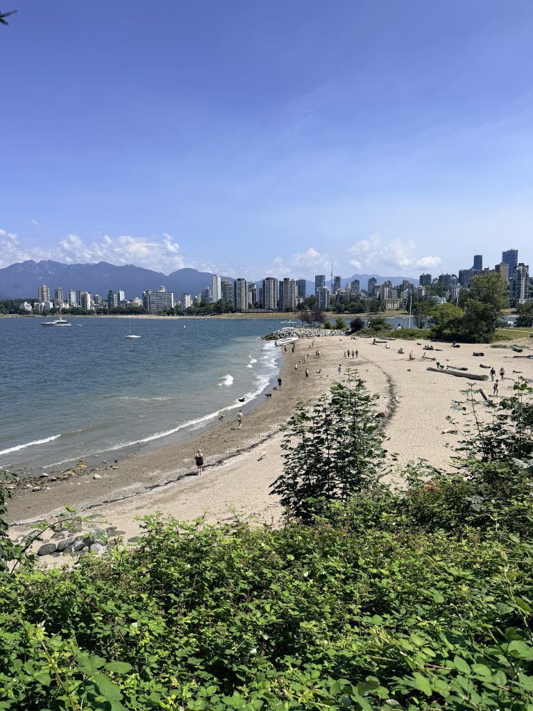
- Kitsilano: Spend time at Kitsilano Beach, browse the Sunday Farmers Market and discover more local experiences in my guide to the best things to do in Kitsilano
- English Bay: Enjoy beach walks, sunset and sailing with views back toward the city and mountains. You can compare sailing, whale watching, cruises and other options in my guide to the best Vancouver boat tours.
- Granville Island: Explore the Public Market, waterfront, independent shops and False Creek ferries. My guide to the best things to do on Granville Island will help you plan your visit beyond the market.
- Stanley Park: Totem poles, the Seawall and the Vancouver Aquarium
- Grouse Mountain: Ride the gondola, watch the Lumberjack Show, visit the resident grizzly bears and take in the views from the Summit Lookout.
- UBC: Botanical Garden and TreeWalk
- For something playful: Playland Attraction Park
Still choosing your Vancouver base? My guide to where to stay in Vancouver compares six areas based on convenience, atmosphere and transportation.
Thinking about visiting Grouse Mountain?
Before booking your ticket – Read my honest review:
Is Grouse Mountain Worth It?
Section 12: Optional Vancouver Island Extension
Driving distance: Approximately 690 kilometres
Driving time: Around twelve hours without extended stops
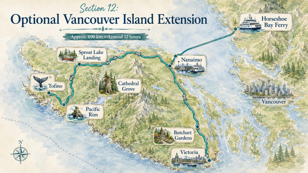
Vancouver Island is worth several days on its own. My 7-Day Vancouver Island Road Trip Itinerary covers the complete route from Nanaimo to Sproat Lake, Tofino and Victoria, including where I stayed and what I would prioritize each day.
From Vancouver, take the ferry from Horseshoe Bay to Nanaimo and make your way toward the west coast. My Vancouver Island Ferry Guide compares the main routes from Vancouver and explains why Horseshoe Bay to Nanaimo works best for this particular road trip.
A few highlights worth building into your route:
- Cathedral Grove old-growth forest
- Sproat Lake Landing
- Long Beach in Pacific Rim National Park Reserve
- Tofino for whale watching or surfing
- Victoria Harbourfront
- Fisherman’s Wharf
- Butchart Gardens
This route requires three main accommodation bases: Sproat Lake, Tofino or Ucluelet, and Victoria. My guide to where to stay on Vancouver Island for a seven-day road trip compares each stop and explains why this combination worked so well.
Explore Tofino and Pacific Rim
In Tofino, I joined a whale-watching tour with The Whale Centre. I did not spot orcas that day, but I saw plenty of gray whales, sea lions and sea otters, and our guide was incredibly knowledgeable.
I later discovered the Whale Locator app, which shows recent whale sightings around Tofino, Victoria and the surrounding coast. If seeing orcas is high on your list, it can give you a better sense of where they have been moving before you book your tour.
Spend time at Long Beach, explore the coastal rainforest and expect the weather to change quickly—even in summer.
If you’re considering booking a tour, read my honest review of whether whale watching on Vancouver Island is worth it. I cover the price, wildlife sightings, boat conditions and what I would recommend knowing before you go.
Visit Victoria
Victoria deserves more than a quick ferry stop. Walk along the Inner Harbour, explore Fisherman’s Wharf, and grab fish and chips at Barb’s—one of my favorite meals on the island.
If you have two full days in the city, follow my 2-Day Victoria, BC Itinerary for a realistic route through the Inner Harbour, Fisherman’s Wharf, the Royal BC Museum, the Gorge Waterway and Butchart Gardens.
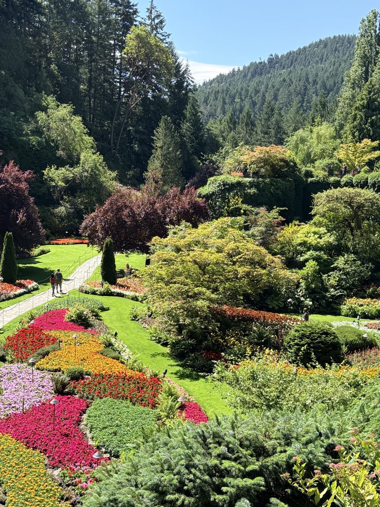
Butchart Gardens was a real highlight for me. The gardens are beautifully designed and absolutely worth making time for. If you’re questioning the admission price or how long to spend there, read my honest review of whether Butchart Gardens is worth visiting.
From Victoria, return to the mainland by taking the ferry from Swartz Bay to Tsawwassen.
Section 13: Optional Sea to Sky Highway Extension
Round-trip distance from Vancouver: Approximately 250 kilometres
Driving time: Around four hours without stops
Recommended time: 1-2 days

This is an optional extension from Vancouver, but it was honestly one of the highlights of my cross-Canada road trip. The Sea to Sky Highway between Vancouver and Whistler is one of Canada’s most scenic drives, with ocean views, mountain roads, waterfalls and forested stops almost the entire way.
I rented a motorcycle for this ride, which made the experience even more memorable. If you have the time, I strongly recommend allowing two days and spending the night in Whistler rather than trying to squeeze everything into one rushed day.
I have a much more detailed breakdown of the route, stops and things to do in my Sea to Sky Highway Road Trip Guide: Vancouver to Whistler, so head there if you want to plan this section in more depth.
A few highlights worth building into your route:
- Porteau Cove Lookout
- Porteau Cove Provincial Park
- Shannon Falls
- Sea to Sky Gondola
- Panorama Trail
- Brandywine Falls
- Whistler Train Wreck Trail
- Whistler Village
Planning to ride the gondola? Read my honest review of whether the Sea to Sky Gondola is worth it before buying your ticket.
Treat the drive itself as part of the experience, not simply the road to Whistler.
If you’re deciding whether to visit the Sea to Sky Gondola during this extension or stay closer to Vancouver with Grouse Mountain, read my Grouse Mountain vs Sea to Sky Gondola comparison before choosing. I compare the views, activities, transportation and type of trip each one suits best.
Section 14: From Vancouver to Okanagan Valley
Driving distance: Approximately 550 kilometres
Driving time: Around seven hours without extended stops

The Okanagan Valley can be added to this itinerary in either direction. You can visit it on the way into Vancouver by continuing through Golden and the Kootenays, or save it for the return journey east.
I personally kept the Okanagan for my drive back home, using Kelowna as my first major stop after Vancouver before continuing south toward Osoyoos and eventually back toward the Rockies.
The exact distance depends on your route, but Vancouver to Kelowna is approximately 370 kilometres and takes around four to five hours. Kelowna to Osoyoos adds approximately 125 kilometres and another two hours of direct driving.
Explore British Columbia’s Wine Country
Explore Kelowna
Begin with a walk along the Kelowna Waterfront Trail, where you will find beaches, parks and views over Okanagan Lake. Check the city’s event calendar before your visit. I happened to see Major Mambo perform during my stay, which added even more energy to the waterfront.
Bike Through Myra Canyon
Cycling Myra Canyon was one of the highlights of my time in the Okanagan.
The historic railway route crosses wooden trestles and passes through tunnels high above the valley. The trail is relatively gentle, but the views make it feel like a true adventure. Reserve a bike in advance during the busy summer season and allow several hours to enjoy the route without rushing.
Stop in Peachland
Continue south and stop near the Peachland Visitor Centre for a picnic beside the lake. The waterfront beach makes an easy break between Kelowna and the southern Okanagan, especially on a warm summer day.
Explore Penticton
For a short hike with wide views, follow the Mount Munson Trail above Penticton. The route leads toward the large Penticton sign and overlooks the city, surrounding hills and Okanagan Lake.
Drive Through Wine Country
Continue south through the vineyards and orchards surrounding Oliver and Osoyoos. Black Sage Road is one of the most scenic drives in the region, passing wineries, dry hills and long rows of vines. Even without planning a full wine-tasting itinerary, the landscape alone makes the drive worthwhile.
Stop at Anarchist Mountain Lookout
Finish with the drive to Anarchist Mountain Lookout near Osoyoos. From above, you can see the town, Osoyoos Lake and the dry southern Okanagan landscape stretching toward the United States border.
The Okanagan feels completely different from coastal British Columbia and the Rocky Mountains. Its warm lakes, vineyards, orchards and dry hills add another distinct landscape to an already incredibly varied cross-Canada journey.
Section 15: From Osoyoos to Banff / Calgary Through the Kootenays
Driving distance: Approximately 960 kilometres
Driving time: Around ten hours without extended stops
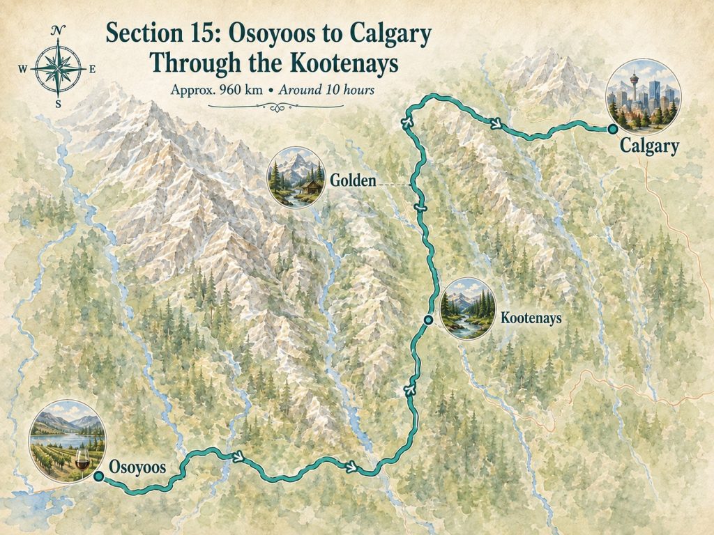
This section of the return journey takes you from the dry Okanagan landscape back toward the Rockies through the Kootenays.
I stayed in Golden, which made a convenient base for exploring nearby Yoho National Park. Unfortunately, wildfires started affecting the region during this part of my trip, so I was not able to enjoy the route as fully as I had planned. Conditions were changing quickly, and I ultimately continued on toward Calgary.
If you drive this section, leave some flexibility in your schedule. The Kootenays are absolutely worth slowing down for.
Section 16: From Calgary to Alberta’s Badlands
Driving distance: Approximately 300 kilometres
Driving time: Around three hours without extended stops
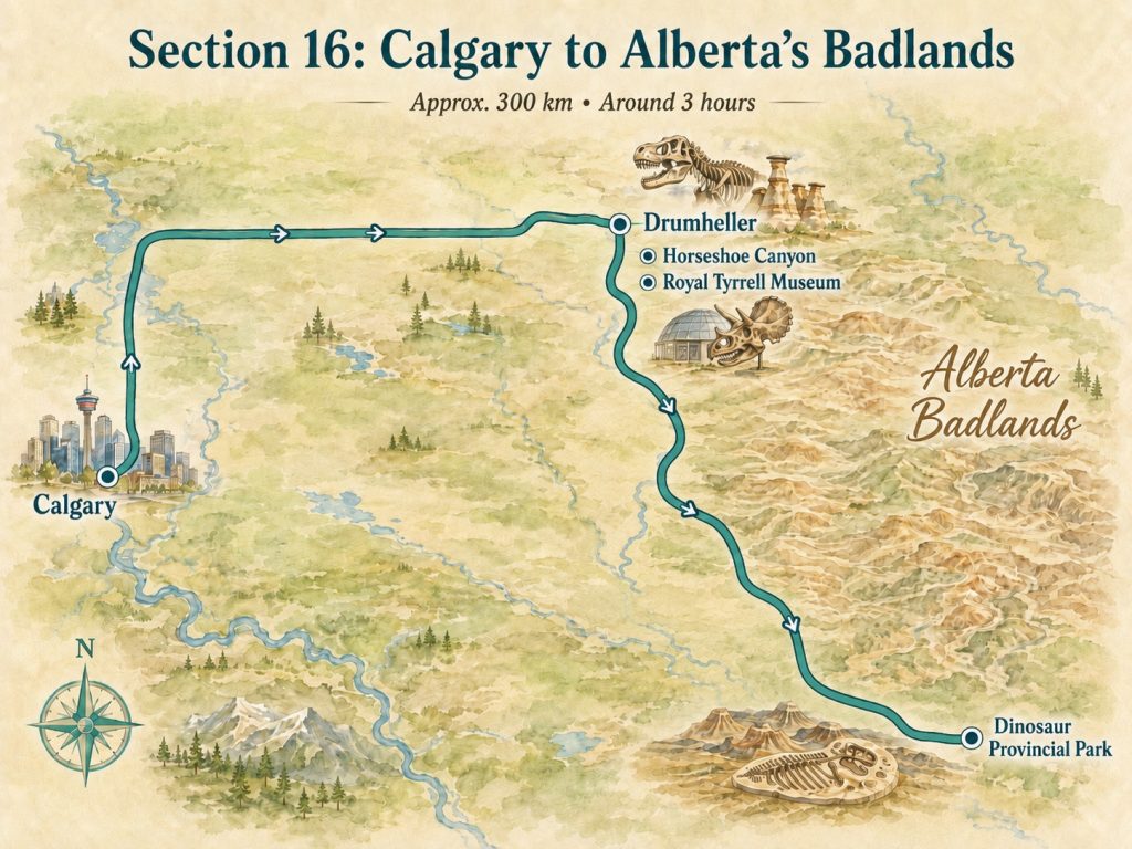
After weeks of mountains, forests, lakes and prairie, arriving in the Alberta Badlands felt like stepping onto another planet. The landscape changes almost suddenly—rolling fields give way to dramatic coulees, hoodoos and exposed layers of rock shaped by millions of years of erosion.
This ended up being one of the true weekend highlights of my cross-Canada road trip, and I would absolutely recommend slowing down here rather than treating it as a quick stop on the way east.
Explore Drumheller
Drumheller is the best-known gateway to the Badlands and makes an easy base for exploring the surrounding landscape.
Highlights include:
- Horseshoe Canyon
- Royal Tyrrell Museum
- World’s Largest Dinosaur
- Star Mine Suspension Bridge
- Willow Creek Hoodoos
- Badlands Interpretive Trail
The Royal Tyrrell Museum was one of my favourite stops. Even if you are not especially interested in dinosaurs, the scale of the fossils, the preservation work and the science behind the discoveries are fascinating. It also gives you much more context for what you are seeing in the landscape around you.
But for me, the experience became even more memorable when I continued south to Dinosaur Provincial Park.
Spend a Day at Dinosaur Provincial Park
Dinosaur Provincial Park deserves its own day.
The landscape here feels wilder and more remote than Drumheller, and this was where I really started to understand just how extraordinary the Badlands are.
I joined the Bonebed Express Hike, a guided experience that takes you into areas not accessible to independent visitors. We visited a Centrosaurus bonebed, saw fossils still embedded in the landscape and learned how paleontologists interpret these sites and piece together what happened millions of years ago.
If you visit in summer, I strongly recommend booking one of the guided fossil programs in advance. You can explore parts of the park independently, but the guided experiences give you access to protected areas and add an entirely different level of meaning to what you are seeing.
If you can, give the Alberta Badlands a full weekend—one day for Drumheller and one day for Dinosaur Provincial Park. This is not just a dinosaur stop. It is one of the most distinctive landscapes in Canada and, for me, one of the most unexpected highlights of the entire journey.
Cross-Canada Road Trip FAQ
How Long Do You Need for a Cross-Canada Road Trip?
For a one-way road trip from Quebec to Vancouver:
- Two weeks: Possible, but very fast-paced
- Three weeks: Enough for a solid cross-country itinerary
- Four weeks: The best balance between driving and exploring
- Five to six weeks: Ideal for slower travel, longer hikes and extra stops
- Seven weeks or more: Ideal for Vancouver Island, optional detours or a more relaxed return journey
If you have the flexibility, I would recommend around four weeks for a one-way trip. Canada is simply too big—and there is too much worth seeing between the major destinations—to rush across it.
How Much Should You Drive Each Day?
Try to keep most driving days between three and five hours. Some sections will be longer, especially in Northern Ontario and Saskatchewan, but several eight-hour days in a row leave little energy for exploring.
My preferred rhythm was to drive for a few hours, stop for a scenic walk or picnic, complete one main activity and arrive before dark.
What Is the Best Time for a Cross-Canada Road Trip?
Late June through early September generally offers the easiest conditions.
Summer brings longer daylight hours, open campgrounds, better hiking conditions and access to seasonal mountain roads.
It is also the busiest and most expensive season in Banff, Jasper, Vancouver and Vancouver Island. Book high-demand accommodation, ferries, campgrounds and guided experiences in advance.
Prepare for dramatically different weather. I experienced hot prairie days, coastal rain, cool Lake Superior nights and glacial mountain water during the same trip.
Can You Drive Across Canada in an Electric Vehicle?
Yes. I completed this road trip in my Ford Mustang Mach-E, and the route is entirely possible in an electric vehicle with some extra planning.
Check charging stations in advance, keep a backup option whenever possible and avoid reaching remote areas with a low battery. A compatible Tesla charging adapter is also worth carrying, as it can open up additional charging locations along the route.
For the full EV side of the journey—including the charging apps I used, range planning, adapters, Tesla Superchargers and what I’d do differently—read my 10 Lessons Learned From My Road Trip Across Canada in an EV.
Should You Plan Every Stop in Advance?
No. Reserve only the experiences that genuinely require advance booking, such as:
- Moraine Lake transportation
- Helicopter tours
- Dinosaur Provincial Park programs
- Vancouver Island ferries
- Whale-watching trips
- Popular national park campgrounds
Leave the rest flexible. A quiet beach, unexpected waterfall, wildlife sighting or picnic beside a lake may become more memorable than the attraction you planned months earlier.
Should You Download Offline Maps?
Absolutely. Mobile service can disappear in Northern Ontario, provincial parks, the Rockies and parts of Vancouver Island.
Save your route, accommodation details, hiking maps, fuel or charging stops and emergency information before leaving town.
Downloading your maps is only part of the preparation; my travel tech essentials guide covers the power bank, charger and connectivity equipment I use on longer trips.
How Often Should You Check Conditions?
Check road and park conditions every morning. Wildfires, construction, floods, trail closures, ferry delays and mountain weather can all affect the route.
A cross-Canada itinerary needs structure, but it also demands flexibility.
How Should You Behave Around Wildlife?
Never approach, feed or block wildlife. Keep an appropriate distance from bears, bison, elk and other animals. Stay inside your vehicle when necessary and follow park guidance. A close photograph is never worth placing yourself—or the animal—at risk.
Is Driving Across Canada Worth It?
Absolutely.
Driving across Canada lets you experience the country’s scale and diversity in a way flying never can—from the forests of Quebec and Ontario to the Prairies, the Rockies and finally the Pacific.
But some of the best moments happen between the famous destinations: beside a quiet lake, along an empty road or during an unplanned stop.
The point is not simply to reach Vancouver. It is to experience everything along the way.